


Choose park
Check in
Check out
Guests
Check in/out
Guests
Search
Cycling in the New Forest offers an immersive experience amidst ancient woodlands, heaths, charming villages, and more. Plus it’s the perfect addition to a Hampshire holiday! So, get ready to explore this beautiful location with loved ones…

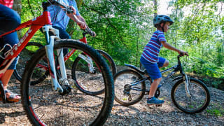
Discover 13 incredible New Forest cycle routes, perfect for families, beginners, and seasoned cyclists alike.
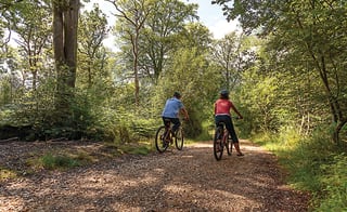
Enjoy over 100 miles of car-free trails, from ancient woodlands to open heathland and charming villages.
Find routes for all ages and abilities, including scenic loops, historic railway paths, coastal rides, and forest climbs.
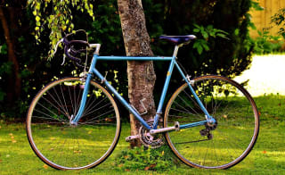
Benefit from easy bike hire options across the New Forest—mountain bikes, e-bikes, kids’ bikes, trailers, and more.
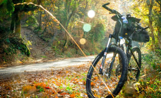
Enhance your adventure with guided cycling tours, offering local insights, nature spotting, and historical highlights.
Stay safe and responsible by following the New Forest Cycling Code and New Forest Code during every ride.
If these amazing cycle routes have you hooked, just picture stepping outside and jumping straight onto the trails! Check out our New Forest holiday homes for sale and see how your dream escape could become your everyday reality.
There are over 100 miles of car-free cycle trails to explore, but where do you even begin? With a variety of cycling options available, including mountain bikes, hybrids, and road bikes, there's something for every cyclist. Plus, there are different options and cycle routes to suit different age ranges. You don’t even have to worry if you don't have your own bike, as numerous places in the area offer bike rentals for any duration you need. You can even store them at the Sandy Balls holiday park during your stay, which is a short distance from all of these cycle routes. So, let’s get started!

Discover the intriguing features of Beaulieu Airfield on this traffic-free cycle route. The ride begins at Roundhill Campsite, which served as accommodation for RAF personnel during WWII and after the war.
North of the main airfield lies Hawkhill Inclosure, where the bomb storage and preparation areas were once hidden in the woods.
Start/Finish: Roundhill Campsite. Grid ref. SU332020. Postcode SO42 7QL
Remember to be cautious of cars and standing water in wet conditions.
Length: 9.1 miles

The old railway line, now part of the National Cycle Network, was dubbed the "Castleman's Corkscrew" due to its winding path across the New Forest. First proposed in 1844, the line connected Southampton and Dorchester, operating for over a century before its closure in the 1960s.
Find out moreThe route begins in Brockenhurst, a charming New Forest village with great rail connections, allowing for car-free exploration of the area, so you can fully enjoy the outdoors.
Start: Brockenhurst Railway Station. Grid ref. SU301020. Postcode SO42 7DW
Finish: Burley Village. Grid ref. SU211031. Postcode BH24 4AB
Remember to be cautious of faster traffic on Burley Road.
Distance: 9 miles

Take in this route's splendid sea views along the New Forest's charming coastline. While easy to ride in dry summer weather, the byways can be muddy and challenging in winter, so a mountain bike is recommended.
Lepe Country Park, where the New Forest meets the sea, offers fantastic views across the Solent and abundant wildlife.
Find out moreNearby, the 200-acre Exbury Gardens are world-famous for the Rothschild Collection of rhododendrons, azaleas, and rare plants.
Start/Finish: Lepe Country Park. Grid ref. SZ455985. Postcode SO45 1AD
Be cautious of traffic, mud, and steep hills along the route.
Distance: 9.3 miles

This cycle ride offers stunning panoramic views of the northern New Forest's rolling hills, heathland, and woodlands, so why not try one of the best New Forest cycle routes on your next holiday?
Start/Finish: Appleslade Bottom car park. Grid ref. SU183093. Postcode BH24 3QT
Distance: 17.8 miles
This predominantly on-road route takes you through some of the New Forest's most stunning open vistas, particularly impressive when the heather blooms in late summer.
Pass the Beaulieu River, which is privately owned by the local estate – a remnant of the area's monastic history and the nearby Buckler's Hard shipyard.
Start/Finish: Ashurst Railway Station. Grid ref. SU333101. Postcode SO40 7AA
Be cautious of traffic, especially when crossing the A35 at the start and end.
Distance: 14 miles
Popular in the New Forest, smuggling (or ‘free trading’ as it was once known) was popular due to cover from woodland and local routes, making it easier to evade capture. Take a journey through history with this New Forest cycle route.
Start/finish: Queens Head Pub. Grid ref. SU211030. Postcode BH24 4AB
Distance: 9.3 miles

Embarking from Brockenhurst, this cycle ride takes you through a part of the New Forest, rich in natural and historical wonders.
The Rhinefield area is home to the tallest trees in the New Forest, with some redwoods reaching up to 50 meters high, so this cycle route in the New Forest is perfect for all of you nature lovers!
Start: Brockenhurst Railway Station. Grid ref. SU301020. Postcode SO42 7DW
Finish: Burley Village. Grid ref. SU211031. Postcode BH24 4AB
Be cautious of uneven road edges, the ford, and traffic throughout the route.
Distance: 10.8 miles

This stunning route between two wonderful New Forest villages allows you to pass through ancient woodlands and enjoy beautiful views along one of the best New Forest cycle routes!
Start/Finish: Lyndhurst Car Park. Grid ref. SU299081. Postcode SO43 7NY
Distance: 23 miles

Starting in the historic Wiltshire village of Downton, on the edge of the New Forest National Park, you’ll end up in the charming Nomansland.
While the route includes a few hill climbs, a rewarding lunch in Nomansland awaits at the end of the journey so you’re refuelled for the rest of your New Forest holiday adventures.
Find out moreStart: Downton Village Centre. Grid ref. SU175215. Postcode SP5 3LZ
Finish: Nomansland Village. Grid ref. SU253173. Postcode SP5 2DB
Distance: 6.8 miles
Take the Hythe Ferry from Southampton to explore the New Forest's open heathland and woodland enclosures on this National Cycle Network Route 2.
Suitable for mountain bikes and hybrids but not road bikes.
Find out moreStart: Southampton Town Quay. Grid ref. SU418109. Postcode SO14 2AQ.
Finish: Brockenhurst Village. Grid ref. SU301019. Postcode SO42 7TW
Be cautious of traffic, especially at junctions and crossings.
Distance: Approximately 12.5 miles

This cycle ride offers stunning panoramic views of the northern New Forest's rolling hills, heathland, and woodlands.
Along one of the best New Forest cycle routes, you'll pass the site of the "Grand Slam" bomb test at Ashley Walk Bombing Range, so discover a little bit of history yourself!
Find out moreStart/Finish: Appleslade Bottom car park. Grid ref: SU183093, Postcode BH24 3QT
Distance: 17.8 miles

Taking you straight from Southampton into the New Forest National Park, look for the well-signposted National Cycle Network 236 leading to Redbridge Causeway. Then, the blue cycleway signs display the National Park logo to Lyndhurst.
Start: Redbridge Roundabout. Grid ref. SU374136. Postcode SO15 0NF
Finish: Lyndhurst. Grid ref. SU301073. Postcode SO43
Distance: 5 miles

Embark on this scenic journey through expansive heathland offering panoramic views of the WWII airfield.
Commence your ride from historic Beaulieu Village, nestled at the head of the Beaulieu River, and on the way back, the route meanders through picturesque woodlands.
Find out moreStart/Finish: Beaulieu High Street. Grid ref. SU386021. Postcode SU387022
Distance: 16.3 miles
Here are some top tips for the smoothest cycling holiday:
If you’re on holiday with no bike then fear not! Numerous cycle hire shops throughout the New Forest offer a variety of bikes, including mountain bikes, electric bikes, road bikes, and kids bikes.
Some also provide trailers for dogs and children, child seats, and even tandems. Jaunt-e Bikes in Milford on Sea offers great rentals.
Plus, you’ll find conveniently located shops include New Forest Cycling in Burley, Cyclexperience in Brockenhurst, and The Woods Cyclery in Lyndhurst, just to name a few.
If you want help with your New Forest cycle routes, especially if you are unfamiliar with the areas, discover the New Forest on a guided cycling tour with expert guides from New Forest Cycling Tours and Wild New Forest. Follow them along forest tracks, pausing at historic sites and observing fascinating nature, all while learning new things.
Their guided bike rides happen regularly, so be sure to check their schedule and book your spot for the next adventure.
When planning your holiday, keep an eye out for various cycling events in the New Forest, including the annual Cycling Festival.
Whether you prefer long-distance rides or leisurely outings, check an events calendar for top cycling happenings across the National Park.
It’s important to ensure both safety and fun while riding in the New Forest, so be sure to check out the New Forest Cycling Guide and the New Forest Code.
Still want some questions answered? Here are the most frequently asked questions about the New Forest cycle routes…
Download Cyclexperience from your app store before your next cycling holiday. This will offer eight popular cycle routes in the New Forest National Park and the Isle of Purbeck.
Discover on Google Play and the Apple Store.
Yes, Google Maps has cycle routes. Click on this quick guide to learn how to use it.
Yes, you can mountain bike in the New Forest, but off-road cycling is restricted to specific routes. Download this cycle map before your visit to check where.
If this list isn’t enough, then yes, the New Forest is good for cycling – amazing even! Exploring the New Forest by bike allows you to immerse yourself in its diverse offerings and connect with its remarkable nature.
From ancient woodlands and picturesque villages to a hidden 40-mile coastline, cyclists can enjoy a range of experiences. Plus, there's plenty of cycle-friendly accommodation available to enhance your journey. So, why not book your next getaway today, so you can experience a number of the best New Forest cycle routes?
Paul is the General Manager at Mill Rythe Coastal Village and he’s passionate about creating memorable experiences for both guests and holiday homeowners, and takes real pride in working with his team to make every stay feel special. Outside of work, Paul enjoys making the most of the local area. You’ll often find him exploring spots like Hayling Island Beach, walking the Hayling Billy Trail, or taking in the views around Langstone Harbour and Northney Marina. He also recommends visiting iconic attractions like Spinnaker Tower and Royal Armouries: Fort Nelson.
Follow Paul Widgery for thoughtful takes, fresh ideas, and inspiring reads.
Whilst you wait... just think about being in your swimmers, the sun's out and the smiles are big
Enter your details to make a payment or request a change
Don't remember your details? Check your confirmation email, or speak to our team
Are you an owner with us? Click here to login