


Choose park
Check in
Check out
Guests
Check in/out
Guests
Search
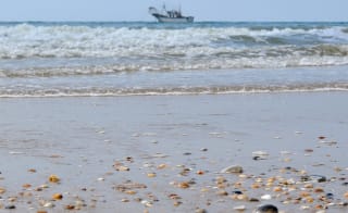
Are you after a fun-filled Hampshire holiday, with plenty of coastal walks in Hampshire to try with your loved ones? Fear not, as we’re here to help you plan your holiday itinerary with these great walks!


Varied Coastal Routes: Hampshire offers everything from short, easy walks like Farlington Marshes and Hamble-le-Rice to longer, scenic routes such as the Solent Way and Brockenhurst circular.
Stunning Natural Beauty: Walks feature diverse landscapes including marshes, estuaries, woodlands, beaches, and dramatic coastlines perfect for nature lovers.
Wildlife & Birdwatching: Trails such as Nutbourne Marshes, Farlington Marshes, and Keyhaven provide excellent opportunities for spotting birds, seals, and other coastal wildlife.
Historic & Cultural Highlights: Coastal walks pass iconic landmarks like Hurst Castle, Portsmouth Historic Dockyard, and the Spinnaker Tower, offering a mix of history and scenery.
Family & Dog-Friendly Options: Many routes are suitable for all ages and abilities, with dog-friendly paths and circular walks ideal for family adventures.
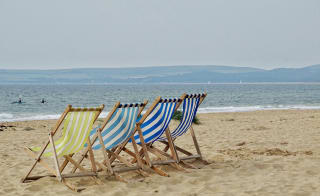
Accessible Holiday Locations: Most Hampshire coastal walks are close to popular holiday parks, making it easy to combine walking adventures with a relaxing coastal break.
If you love exploring Hampshire’s stunning coastal walks, just imagine stepping outside your door straight into them! Browse our Hampshire holiday homes for sale and discover how your dream seaside escape could become your everyday reality.
Whether you want to tackle parts of The Solent Way 60-mile walk or venture from Keyhaven to visit Hurst Castle, there are so many great walks to choose from!
This is why we’ve compiled a list of 13 of the best ones that you can discover during your next holiday. And what makes them even better is that they’re based close to some of the best holiday parks that will make your stay that extra bit special!
So, what are you waiting for? Check out these brilliant walks so that you’re prepared for your next Hampshire holiday.
Starting with the stunning New Forest location full of woodlands and wildlife, we’re sure that you will enjoy your time here, especially with these amazing coastal walks in the area and the national park.

A perfect and simple route to begin your New Forest walks near Blackfield, Hampshire, it’s an extremely popular area for hiking, running, and walking.
Find out more
As the trail is open all year round, you can explore its beauty whenever you choose to book your holiday, especially as the area is between a 40–50-minute drive from Sandy Balls holiday park! The perfect location to come and visit such pretty views.
Set off from Lepe Beach car park and head towards the beach. Cross the road and follow the stony coastline westward, passing by cottages, a boathouse, and a lighthouse. The Lepe House and Gardens will be on your right. At the path split, follow the right fork, or continue along the beach if the tide is low.
Turning right at the fork, follow the lane west, passing Inchmery House on your left. The lane meets the end of the beach – continue north, then turn right onto a path through meadows and forest. Proceed past the first intersection and turn right at the T-junction to head east.
Cross a lane, continue on the widening track through farmland, and turn right onto a path back towards the farm before bending south. This path crosses a marshy area and eventually reaches a fork - turn left through a gate to return to the starting car park.
As is common for walks in this area, the paths may be muddy during winter or after rainfall, so appropriate footwear, such as sturdy shoes or boots, is recommended.
Length: 4.1 miles
Difficulty: Easy

Another popular route for explorers, even though it’s a fan favourite, you can still enjoy some tranquil walks here. And if you’re holidaying between March and October, that's even better – as these are the perfect times to walk here!
Find out moreFrom Brockenhurst Station, head down Brookley Road, passing the cycle shop and Foresters Arms pub. Continue to the Watersplash Ford, then turn right onto Rhinefield Road. After 400m, turn left across Black Knowl.
At the end, turn right into the trees towards Bolderford Bridge. Go through the gate and follow the cycle path into New Park Plantation, turning left. Continue through the inclosures, exiting onto Pinkney Lane. Turn left to refuel, or right back towards Lyndhurst.
In Lyndhurst, cut through Sandy Lane towards the centre. Pass the King's House, an imposing historic building that houses the Court of Verderers. Next to it is St Michael and All-Angels Church, with a graveyard containing the memorial to Alice Lidell.
Exit the churchyard onto Church Lane, turn left onto the High Street, and right onto Gosport Lane. Follow Gosport Lane past Goose Green, to Beechan Lane. Enter the forest enclosure and continue straight until reaching a cycle route marker, then turn right.
Follow the gravel path, turning right at the next junction. Proceed 250m, turn left downhill, then right and continue 400m to a fork. Take the left fork downhill through a gate. Cut through the campsite to the A337, passing Brockenhurst Beach on the way back to the train station.

This windy route will take you around the picturesque countryside of the New Forest. You will pass through Howen Bush, Hallickshole Hill, and Pitts Wood Inclosure, making for one of the best coastal walks in Hampshire!
Find out moreFrom the car park (at the Royal Oak pub on your right, take a turnoff on your left 328 ft past the pub for the car park), go through the gate and follow the southwest-bound track, ignoring the branching paths. At the first junction, bear left to continue. Cross the Dockens Water footbridge, then turn right. Pass the first left turn, taking the second one after the cottage and another small footbridge. At the four-way junction, turn right to walk through the wooded Broomy Inclosure near the Dockens Water.
Take the first right onto a northbound footpath, crossing the river into an open area. Turn left onto the track, then take the first right, curving footpath around the Halsey Inclosure. Cross Latchmore Brook and continue north to Ditch End. From there, follow the eastbound track into the Pitts Wood Inclosure.
Stay right at the next two forks. As you exit Pitts Wood, turn left onto the footpath heading northeast, joining a track to the road's edge. Turn right onto the cycleway, then left onto the footpath. Cross a footbridge, go right onto a track, quickly left, and right at the intersection. Bear left at the final fork and follow this to the Royal Oak, across from the car park.
With plenty of wildflowers and wildlife to see during this walk, you’re truly spoilt for choice! Plus, you can visit all year round, no matter when you book your Hampshire holiday for!
Find out moreAs you exit Exbury Gardens car park, walk on the road to reach the public footpath, passing the Parish Church of St Katherine's on your left.
Once on the footpath, you'll see views of the beautiful surrounding fields, which can get muddy in wet conditions.
Then, you'll walk along a quiet country road to the next path, leading you through more fields. Be cautious on the narrow, uneven section with potential stinging nettles.
You'll emerge onto a wide, open country lane and cross several more fields. Catch glimpses of the sea over the hill – a sign you're nearing the Lepe beach portion of the walk.
At the beach, follow it to the end. Be mindful of high tide, which may cut off your path, so time your walk accordingly. At the end of the beach, you'll reach some large rocks connecting to a road. Follow the road briefly to rejoin the public footpath for the final leg back to the car park.
Length: 6 miles
Difficulty: Easy

Try this refreshing seaside walk along Hurst Spit leading to Hurst Castle. You'll pass through the picturesque village of Keyhaven, with its fishing boats and sailing yachts, and enjoy gorgeous views of The Needles and the Isle of Wight. You can take the Hurst Castle Ferry back from the spit or continue walking back down and complete the circular route.
Find out moreWhatever you choose to do makes this one of the most unique coastal walks in Hampshire!
Start in Milford on Sea Village Centre and follow the path next to the Sea Road Car Park. At Glebe Lane, continue on the gravel track through to Sturt Pond.
Walk alongside Sturt Pond until you reach the coast, then follow the spit up to Hurst Castle. You can walk as far along the spit as you'd like before returning the same way.
Once back, turn right up Saltgrass Lane. Cross the road and follow the path towards Keyhaven Marshes, making a left to walk past the Hurst Castle Ferry, alongside the marshes and boatyards.
After this, turn left onto Lower Pennington Lane and right onto Keyhaven Road, following this quiet country road back into Milford on Sea Village.

The Solent Way section between Lymington River and Keyhaven is one of the best spots in Hampshire, offering beautiful coastal scenery. From Keyhaven, you can visit Hurst Castle and the lighthouse at the end of the shingle spit, either taking the ferry or walking one or both ways.
Find out moreStart at Bath Road car park, Lymington. From the Lifeboat Station slipway, follow the Solent Way Sea wall path past the Lymington Sea Water Baths and through the Lymington Yacht Haven boatyard. Turn left between the boat hulls onto a narrow path.
At the junction, turn left to continue along the sea wall, with the Normandy Marsh Nature Reserve and Keyhaven/Pennington Marshes on your right.
To reach Keyhaven, turn left at the lane and follow the path past the Yacht Club to the Hurst Castle ferry. From the spit, enjoy views of the Needles and the Isle of Wight.
If you want to visit some other parts of Hampshire, here are some of the best coastal walks in these areas, which cover locations including Portsmouth and Southampton…

Looking at other coastal walks in Hampshire, why not try this beautiful trail in the Chichester Harbour Area of Outstanding Natural Beauty? Starting at the Nutbourne Marshes bird sanctuary, this circular route takes you around the Cobnor Point peninsula and along the Bosham Channel before cutting back across the peninsula.
Find out moreStarting at Nutbourne, following the path to the water's edge, you'll pass the remnants of a former tidal mill. Continue around the Nutbourne Channel, where you may spot wintering geese and seals in the harbour.
Carry on to the southernmost point of the peninsula at Cobnor Point, then head back across, passing the Chidham village. Marsh Lane is a private road, so do not use this.

A stroll around Langstone Harbour can be quite refreshing! Langstone Harbour is located on the south coast of England, near Portsmouth. It's a beautiful area known for its scenic views, diverse wildlife, and peaceful atmosphere. The harbor itself is home to many bird species and is a designated Site of Special Scientific Interest (SSSI) due to its ecological importance.
Find out moreEastney Point to Milton Lock: Starting from Ferry Point, follow the path along Eastney Lake, crossing over Milton Lock. If the tide is high, divert inland along Fort Cumberland Road.
Milton Lock to Ports Creek: Continue along the sea wall, passing landmarks like Milton Common, Salterns Mansion, and Kendall's Wharf. Cross the bridge over Ports Creek.
Ports Creek to Hermitage Stream: Take the steps onto the sea wall at Farlington Marshes, either circling the reserve or taking the inland path. Follow the harbour's edge to Hermitage Stream.
Hermitage Stream to Langstone: Cross under Harts Farm Way, then continue past the industrial area to the footpath along Hermitage Stream. Skirt Budds Farm, reaching the shoreline again before turning inland at Lavant Stream. Cross to Mill Lane and follow the old railway line to Langstone.
Langstone to West Town: Cross into Hayling Island, then take the footpath along the former Hayling Billy railway line. Detour to the Old Oysterbeds before continuing to West Town.
West Town to Ferry Point: Turn right on Sinah Lane, then left into Warren Close. Follow the footpath to Ferry Road, walking along the golf course to reach Ferry Point.

Perfect for all nature lovers, Farlington Marshes Nature Reserve is a paradise for birding, with a wide variety of birdlife to be spotted. The perfect Hampshire coastal walk, plus it’s only a 15-minute drive from Mill Rythe holiday park!
Find out moreStarting at the car park along Farlington Roundabout, follow the waterside path to the edge of Farlington Marshes. There are two more car parks along the way if the first is full. At the last one, you'll find a board listing recent bird sightings.
Walk along the shoreline, enjoying views across the 123-hectare marshes, home to a variety of birds like egrets, herons, and owls. Follow the perimeter path all the way around, taking in the reedbeds, before returning to the starting car parks.

With plenty of flora and fauna, plus the ability to bring your dog (on a lead) for this brilliant short walk, it’s a perfect experience to add to your holiday itinerary!
Find out moreStart at the Hamble village square, where there is parking available.
Follow the Hamble Foreshore path, then enter the woods at the village green. Emerge at Avery's Field and turn left along the River Hamble.
After a kissing gate, the path meets the road at the Marina entrance. Turn left onto Copse Lane, then right onto the High Street, passing the Priory Church of St Andrew.
Head towards Hamble House Gardens, following the footpath through the recreation ground. Turn right onto Satchell Lane, before returning to the village square.

Two brilliant parts of Hampshire, Southampton and Portsmouth are busy ports, but this circular route close to the village of Warsash is a mixture of countryside and coastline, making for one of the best coastal walks in Hampshire where you can discover different parts.
Find out moreStarting and ending at Workman's Lane, you’ll see views of Hook Lake along the way - accessible year-round.
Following Workman's Lane to the coast, the trail heads along the Solent Way, tracking the coastline before turning uphill towards Hook Park Road.
Cross the road into the Hook with Warsash Nature Reserve, following the track to a T-junction, then turning right through grasslands back to the starting point.
Hayling Island proudly holds a European Blue Flag award and a Tidy Britain Seaside Award for their water quality, safety and cleanliness. If this wasn’t enough to try this coastal walk, then see what other stunning things you can find here!
Find out moreBeginning at the Havant train station car park, follow the marked path to New Lane and under the A27 before reaching Langstone. Stop at the Ship Inn for views across Langstone Harbour.
Cross the road bridge onto Hayling Island and rejoin the old train line, following the coast to Hayling town. Retrace your steps back to Havant.
You can also access this path at various points along it, with the Ship Inn car park providing a good starting point to do the northern or southern sections.

You would have already seen parts of this walk mentioned, but as it covers 60 miles, there is a lot to be explored, which is why many split it up in parts.
You would have already seen parts of this walk mentioned, but as it covers 60 miles, there is a lot to be explored, which is why many split it up in parts.
The Solent Way is a scenic coastal walking route in Hampshire, spanning eight sections from Milford-on-Sea to Emsworth. The trail offers views of the Hampshire countryside, Solent, and the Isle of Wight, and can be enjoyed year-round.
It will take you through diverse landscapes, including the New Forest, Southampton, Portsmouth, quaint fishing villages, yacht marinas, marshland, and saltings.
The route is well-marked with signs featuring a white bird silhouette in a green arrow. Walkers can access the trail at various car parks located along its length to break up the 60-mile journey as needed.
Will you be tackling this overarching Hampshire coastal walk on your next holiday?
Here are some of the attractions you can see along the way:
There are so many places to hike here due to the number of coastal walks in Hampshire – you’re spoilt for choice! Whether you want to explore the New Forest, Portsmouth, or Southampton, there’s something for everyone…
So, if you’re holidaying with the family, yourself, as a couple, or with the dog, there are plenty of walks to suit your needs. Why not book your Hampshire holiday today, so you can see just how delightful these walks are?
Hampshire | Scotland | Isle of Wight | Dorset | North Wales | Yorkshire | Lincolnshire | Cornwall
Paul is the General Manager at Mill Rythe Coastal Village and he’s passionate about creating memorable experiences for both guests and holiday homeowners, and takes real pride in working with his team to make every stay feel special. Outside of work, Paul enjoys making the most of the local area. You’ll often find him exploring spots like Hayling Island Beach, walking the Hayling Billy Trail, or taking in the views around Langstone Harbour and Northney Marina. He also recommends visiting iconic attractions like Spinnaker Tower and Royal Armouries: Fort Nelson.
Follow Paul Widgery for thoughtful takes, fresh ideas, and inspiring reads.
Whilst you wait... just think about being in your swimmers, the sun's out and the smiles are big
Enter your details to make a payment or request a change
Don't remember your details? Check your confirmation email, or speak to our team
Are you an owner with us? Click here to login